


When it comes to exploring the stunning landscapes of Great Britain, having reliable and detailed navigation tools is essential. For decades, Ordnance Survey has been the gold standard in mapping, trusted by hikers, cyclists, campers, and adventurers alike. Among its impressive suite of products, one stands out as a game changer in the digital age: the OS Maps app.
What is OS Maps?
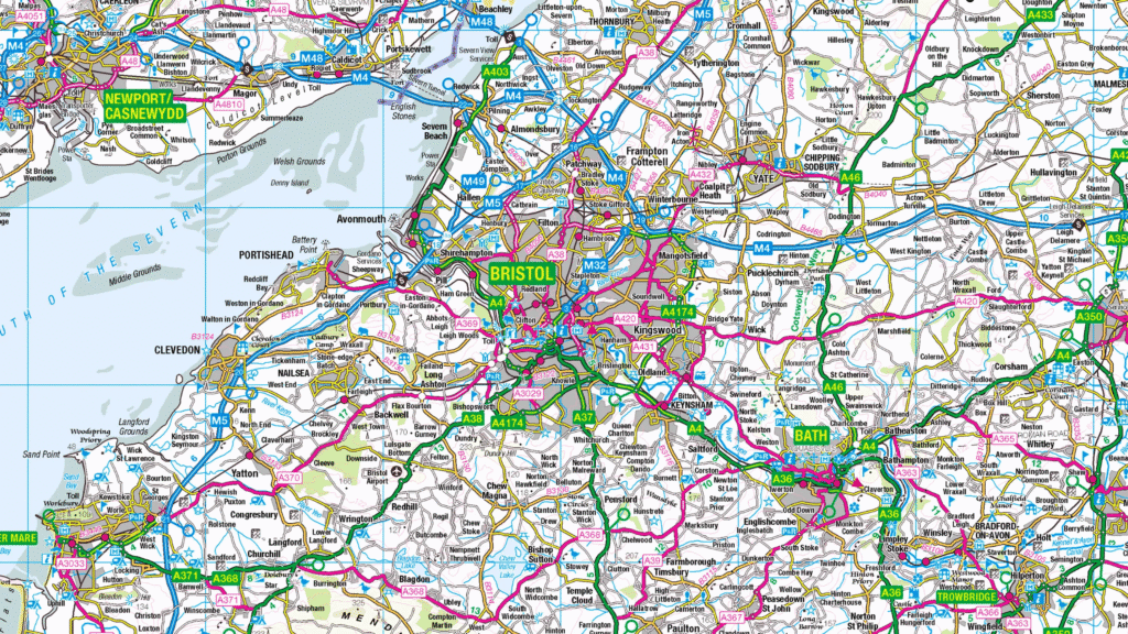
OS Maps is a comprehensive digital mapping and navigation application developed by Ordnance Survey. It offers detailed, interactive maps of Great Britain, providing users with the same high-quality cartographic information that the agency has been renowned for since 1791. Whether you’re planning a day hike, a cycling route, or a weekend of wild camping, OS Maps ensures you have all the tools you need right at your fingertips.
Key Features of OS Maps
The strength of OS Maps lies in its versatility and rich feature set. Here are some of the standout features that make it a top-rated choice among outdoor enthusiasts:
- Detailed Mapping Layers:
The app offers access to Ordnance Survey’s iconic 1:25,000 and 1:50,000 scale maps, which are known for their precision and detail. Users can switch between different layers, including aerial imagery and National Park pathways, to get a full picture of their environment. - Route Planning and Recording:
OS Maps allows users to plot routes easily, calculate distances, and estimate times. You can save and share routes with others, and even record your journey in real-time using GPS tracking. This is perfect for keeping a log of your adventures or sharing your favorite trails. - Offline Access:
One of the app’s most valued features is the ability to download maps for offline use. This ensures that even in remote areas with poor mobile reception, you can still navigate confidently using your saved maps. - 3D Mapping:
For those who want a more immersive experience, OS Maps provides 3D mapping capabilities. This feature lets users visualize the terrain in three dimensions, offering better insight into elevation changes and landscape features. - Augmented Reality (AR):
The AR tool enables users to point their phone’s camera at a landscape and identify hills, peaks, and other landmarks in real-time. It’s a fantastic educational tool and adds a new layer of interactivity to outdoor adventures.
Why OS Maps Stands Out
In a crowded market of navigation apps, OS Maps distinguishes itself with unrivaled accuracy and reliability. Unlike many generic mapping apps, Ordnance Survey is deeply rooted in the geography of Great Britain, offering a level of detail that is simply unmatched.
The app is not only for serious hikers and climbers but also for casual walkers, families, and educators. Its user-friendly interface makes it accessible to all experience levels, and the wealth of pre-planned routes ensures that anyone can find something that suits their needs.
Another reason for its popularity is its commitment to continuous improvement. Ordnance Survey regularly updates the app with new features and keeps its maps current, reflecting changes in the landscape and infrastructure.
The Importance of Reliable Mapping
In outdoor activities, safety is paramount. Reliable navigation can mean the difference between a great day out and a potentially dangerous situation. OS Maps offers peace of mind with accurate paths, landmarks, and terrain data, reducing the risk of getting lost.
Moreover, the app contributes to conservation by promoting responsible outdoor behavior. With tools like route-sharing and area guides, OS Maps encourages users to respect nature, stick to designated paths, and minimize their environmental impact.
Who Uses OS Maps?
OS Maps is popular among a broad spectrum of users:
- Hikers and Trekkers rely on its detailed topographical information.
- Cyclists and Mountain Bikers use it to find and plan the best routes.
- Educators and Researchers utilize its precise mapping for teaching and field studies.
- Families and Casual Walkers enjoy pre-planned scenic routes and local trail suggestions.
Whether you’re a weekend warrior or a seasoned explorer, OS Maps provides the tools you need to venture out with confidence.
Conclusion
In a world where digital tools are becoming integral to every aspect of life, Ordnance Survey has successfully brought its legendary cartographic expertise into the 21st century with the OS Maps app. It is more than just a navigation tool—it is a gateway to adventure, exploration, and a deeper connection with the beautiful landscapes of Great Britain.
For anyone passionate about the outdoors, OS Maps is an indispensable companion. It reflects the best of what Ordnance Survey stands for: precision, reliability, and a commitment to helping people explore safely and responsibly.
If you’re planning your next adventure, make sure OS Maps is part of your toolkit—you won’t want to leave home without it.


